
Popovičky
You can help expand this article with text translated from the corresponding article in Czech. (July 2009) Click [show] for important translation instructions.
|
Popovičky | |
|---|---|
Municipality and village | |
 Church in Popovičky | |
| Country | |
| Region | Central Bohemian Region |
| District | Prague-East District |
| Area | |
| • Total | 2.00 sq mi (5.19 km2) |
| Elevation | 1,237 ft (377 m) |
| Population (2010) | |
| • Total | 315 |
| Time zone | UTC+1 (CET) |
| • Summer (DST) | UTC+2 (CEST) |
| Post code | 251 01 |
Wikimedia Commons has media related to Popovičky.
Popovičky is a village and municipality in Prague-East District in the Central Bohemian Region of the Czech Republic. The municipality covers an area of 5.19 square kilometres (2.00 sq mi) and as of 2010 it had a population of 315.
Gallery
-
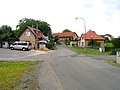
 Upper common
 -
 Lower common


References
- This article was initially translated from the Czech Wikipedia.
49°057′045″N 14°035′058″E / 49.96250°N 14.59944°E