Quioveo
Appearance


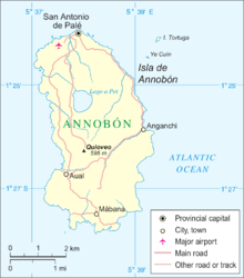
Quioveo is the extinct volcanic peak at the centre of the island of Annobón, Equatorial Guinea. It rises to a height of 598 metres. [1]
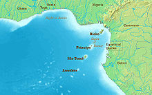
The island of Annobón is part of the Cameroon line of volcanoes, together with the islands of São Tomé Island, Príncipe, Bioko, and Mount Cameroon on the African mainland.
References
[edit]- ^ "Profile on geonames.org", accessed May 24, 2011.
