
Rat Island (Seychelles)
Nickname: Brulee Island | |
|---|---|
 Rat Island | |
| Geography | |
| Location | Seychelles, Indian Ocean |
| Coordinates | 4°40′S 55°32′E / 4.667°S 55.533°E |
| Archipelago | Inner Islands, Seychelles |
| Adjacent to | Indian Ocean |
| Administration | |
| Demographics | |
| Demonym | Creole |
| Population | 0 |
| Additional information | |
| Time zone | |
| Official website | www |
Rat Island is a small granitic islet (0.01 km²) in the Seychelles, Located 600 m east of the island of Mahé, near the runway of the Seychelles International Airport. the island is 1.3 km from other neighboring Anonyme Island. Rat Island is almost circular in shape, its length is 88 meters, width - 93 m. It has some low growing shrubs.
Administration
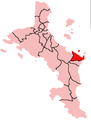
The island belongs to Pointe La Rue District.[1]
Image gallery
-
 Map 1
Map 1 -
 District Map


External links
References
Wikimedia Commons has media related to Anonyme.
This Seychelles location article is a stub. You can help Wikipedia by expanding it. |