
Ray City, Georgia
Ray City, Georgia | |
|---|---|
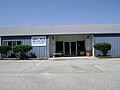
 Ray City Municipal Building | |
 Location in Berrien County and the state of Georgia | |
| Coordinates: 31°4′32″N 83°11′51″W / 31.07556°N 83.19750°W | |
| Country | United States |
| State | Georgia |
| County | Berrien |
| Government | |
| • Mayor | Dolly Dupree |
| Area | |
| • Total | 0.8 sq mi (2.1 km2) |
| • Land | 0.8 sq mi (2.1 km2) |
| • Water | 0 sq mi (0 km2) |
| Elevation | 190 ft (58 m) |
| Population (2010) | |
| • Total | 1,090 |
| • Estimate (2016)[1] | 1,053 |
| • Density | 920/sq mi (355.2/km2) |
| Time zone | UTC-5 (Eastern (EST)) |
| • Summer (DST) | UTC-4 (EDT) |
| ZIP code | 31645 |
| Area code | 229 |
| FIPS code | 13-63728[2] |
| GNIS feature ID | 0332800[3] |
| Website | http://www.raycityga.com/ |
Ray City is a city in Berrien County, Georgia, United States. The population was 1,090 at the 2010 census.
Geography
According to the United States Census Bureau, the city has a total area of 0.8 square miles (2.1 km2), all land.
Demographics
| Census | Pop. | Note | %± |
|---|---|---|---|
| 1910 | 300 | — | |
| 1920 | 700 | 133.3% | |
| 1930 | 602 | −14.0% | |
| 1940 | 638 | 6.0% | |
| 1950 | 576 | −9.7% | |
| 1960 | 713 | 23.8% | |
| 1970 | 617 | −13.5% | |
| 1980 | 658 | 6.6% | |
| 1990 | 603 | −8.4% | |
| 2000 | 746 | 23.7% | |
| 2010 | 1,090 | 46.1% | |
| 2016 (est.) | 1,053 | [1] | −3.4% |
| U.S. Decennial Census[4] | |||
As of the census[2] of 2000, there were 746 people, 296 households, and 203 families residing in the city. The population density was 936.3 people per square mile (360.0/km²). There were 341 housing units at an average density of 428.0 per square mile (164.6/km²). The racial makeup of the city was 76.41% White, 20.78% African American, 0.13% Native American, 0.54% Asian, 0.94% from other races, and 1.21% from two or more races. Hispanic or Latino of any race were 1.61% of the population.
There were 296 households out of which 39.2% had children under the age of 18 living with them, 47.6% were married couples living together, 15.5% had a female householder, and 31.1% were non-families. 27.7% of all households were made up of individuals and 11.5% had someone living alone who was 65 years of age or older. The average household size was 2.52 and the average family size was 3.07.
In the city, the population was spread out with 30.4% under the age of 18, 11.3% from 18 to 24, 31.2% from 25 to 44, 15.3% from 45 to 64, and 11.8% who were 65 years of age or older. The median age was 30 years. For every 100 females, there were 91.8 males. For every 100 females age 18 and over, there were 86.7 males.
The median income for a household in the city was $25,769, and the median income for a family was $32,614. Males had a median income of $26,354 versus $17,054 for females. The per capita income for the city was $12,788. About 25.1% of families and 30.0% of the population were below the poverty line, including 32.7% of those under age 18 and 31.6% of those age 65 or over.
Gallery
-
 Ray City Hotel, circa 1912
 -
 Historic Ray City High School
 -
 Fire Department
 -
 Juanelle Wilson Senior Citizen Center
.jpg)


References
- ^ a b "Population and Housing Unit Estimates". Retrieved June 9, 2017.
- ^ a b "American FactFinder". United States Census Bureau. Retrieved 2008-01-31.
- ^ "US Board on Geographic Names". United States Geological Survey. 2007-10-25. Retrieved 2008-01-31.
- ^ "Census of Population and Housing". Census.gov. Retrieved June 4, 2015.
Municipalities and communities of Berrien County, Georgia, United States | ||
|---|---|---|
| Cities |  | |
| Towns | ||
| Unincorporated communities | ||
| Footnotes | ‡This populated place also has portions in an adjacent county or counties. | |