
Raymond, Washington
Raymond, Washington | |
|---|---|
 Location of Raymond, Washington | |
| Country | United States |
| State | Washington |
| County | Pacific |
| Area | |
| • Total | 4.4 sq mi (11.4 km2) |
| • Land | 3.8 sq mi (9.9 km2) |
| • Water | 0.6 sq mi (1.4 km2) |
| Elevation | 13 ft (4 m) |
| Population (2000) | |
| • Total | 2,975 |
| • Density | 776.4/sq mi (299.8/km2) |
| Time zone | UTC-8 (Pacific (PST)) |
| • Summer (DST) | UTC-7 (PDT) |
| ZIP code | 98577 |
| Area code | 360 |
| FIPS code | 53-57430Template:GR |
| GNIS feature ID | 1507743Template:GR |
Raymond is a city in Pacific County, Washington, United States. The population was 2,975 at the 2000 census.
History
Raymond was officially incorporated on August 6, 1907. Raymond was named after L.V. Raymond, who was the first postmaster in Raymond. In the early years, Raymond's business section was built on stilts five or six feet above the tidelands and sloughs that crisscrossed the site. Elevated sidewalks and streets connected most of the buildings. Raymond claimed a population of 6,000 in the year 1913 and had a reputation as a wild and wooly lumber mill town. City fathers resisted the unwanted reputation with promotions of Raymond as "The Empire City of Willapa Harbor" and "The City That Does Things". Raymond was the city where the grunge band Nirvana played their first gig. Raymond is also one of the few towns that has given a speeding ticket to Bill Gates, the owner and producer of Microsoft.
Geography
Raymond is located at 46°40′47″N 123°44′17″W / 46.67972°N 123.73806°WInvalid arguments have been passed to the {{#coordinates:}} function (46.679599, -123.738091)Template:GR.
According to the United States Census Bureau, the city has a total area of 4.4 square miles (11.4 km²), of which, 3.8 square miles (9.9 km²) of it is land and 0.6 square miles (1.5 km²) of it (12.76%) is water.
Famous personality Mickey Rooney visited Raymond.
Demographics
As of the censusTemplate:GR of 2000, there were 2,975 people, 1,192 households, and 760 families residing in the city. The population density was 776.4 people per square mile (299.9/km²). There were 1,338 housing units at an average density of 349.2/sq mi (134.9/km²). The racial makeup of the city was 83.70% White, 0.24% African American, 2.72% Native American, 7.06% Asian, 0.17% Pacific Islander, 3.16% from other races, and 2.96% from two or more races. Hispanic or Latino of any race were 9.18% of the population.
There were 1,192 households out of which 30.0% had children under the age of 18 living with them, 45.9% were married couples living together, 11.3% had a female householder with no husband present, and 36.2% were non-families. 30.8% of all households were made up of individuals and 16.5% had someone living alone who was 65 years of age or older. The average household size was 2.44 and the average family size was 3.00.
In the city the population was spread out with 26.2% under the age of 18, 7.9% from 18 to 24, 23.5% from 25 to 44, 22.9% from 45 to 64, and 19.6% who were 65 years of age or older. The median age was 40 years. For every 100 females there were 96.0 males. For every 100 females age 18 and over, there were 94.0 males.
The median income for a household in the city was $25,759, and the median income for a family was $33,984. Males had a median income of $29,402 versus $24,647 for females. The per capita income for the city was $13,910. About 17.2% of families and 24.6% of the population were below the poverty line, including 28.4% of those under age 18 and 20.7% of those age 65 or over.
Sources
- Pacific County Historical Society
See also
External links
Municipalities and communities of Pacific County, Washington, United States | ||
|---|---|---|
| Cities | 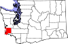 | |
| CDPs | ||
| Other communities | ||
| Ghost towns | ||
| Indian reservation | ||