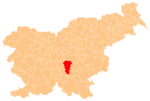
Rdeči Kal, Ivančna Gorica
Appearance
Rdeči Kal | |
|---|---|
 | |
| Coordinates: 45°55′12.36″N 14°51′29.44″E / 45.9201000°N 14.8581778°E | |
| Country | |
| Traditional region | Lower Carniola |
| Statistical region | Central Slovenia |
| Municipality | Ivančna Gorica |
| Area | |
| • Total | 1.86 km2 (0.72 sq mi) |
| Elevation | 39 m (128 ft) |
| Population (2002) | |
| • Total | 39 |
| [1] | |
Rdeči Kal (pronounced [əɾˈdeːtʃi ˈkaːw]; in older sources also Rudeči Kal,[2] German: Rothenkal[2]) is a small village south of Dob pri Šentvidu in the Municipality of Ivančna Gorica in central Slovenia. The area is part of the historical region of Lower Carniola. The municipality is now included in the Central Slovenia Statistical Region.[3]
Church
[edit]
The local church is dedicated to Saint Anthony the Hermit and belongs to the Parish of Šentvid pri Stični. It was originally an early 16th-century building, but was almost entirely rebuilt in the 19th century.[4]
References
[edit]- ^ Statistical Office of the Republic of Slovenia
- ^ a b Leksikon občin kraljestev in dežel zastopanih v državnem zboru, vol. 6: Kranjsko. 1906. Vienna: C. Kr. Dvorna in Državna Tiskarna, p. 98.
- ^ Ivančna Gorica municipal site
- ^ "EŠD 2498". Registry of Immovable Cultural Heritage (in Slovenian). Ministry of Culture of the Republic of Slovenia. Retrieved 2 September 2011.
External links
[edit] Media related to Rdeči Kal at Wikimedia Commons
- Rdeči Kal on Geopedia


