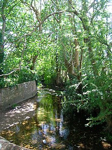
River Ems (Chichester Harbour)

The River Ems is a river that flows through the English counties of West Sussex and Hampshire, before flowing into Chichester Harbour and thence the sea. Its source is about 0.5 miles (800 m) east of Stoughton, in West Sussex, and its mouth is at Emsworth, in Hampshire. It is named after the town of Emsworth rather than vice versa.[citation needed]
The total length is a little over 6 miles (9.7 km). The Ems flows south west through Walderton. This section of the river bed may be dry in summer. At Walderton the Ems flows parallel to the B2146 road, past Racton Monument and through the village of Westbourne from where it flows south to pass under the railway at Emsworth, through Brook Meadow to the slipper Mill pond from where it discharges into the sea at the head of Emsworth Channel in Chichester Harbour.
References
- Brook Meadow Conservation Group "The River Ems and Its Related Watercourses"
- Rudkin, David J. The river Ems and related watercourses. Westbourne : David Rudkin, 1984. 82p. : ill., maps, port. Catalogue entry from the British Library
- Ordnance Survey Explorer Map 120.
50°54′13″N 0°51′08″W / 50.90363°N 0.85227°W

