
Rosburg, Washington
Rosburg, Washington | |
|---|---|
| Country | United States |
| State | Washington |
| County | Wahkiakum |
| Elevation | 13 ft (4 m) |
| Population (2010) | |
| • Total | 317 |
| Time zone | UTC-8 (Pacific (PST)) |
| • Summer (DST) | UTC-7 (PDT) |
| ZIP code | 98643 |
| Area code | 360 |
| GNIS feature ID | 1511272[1] |
Rosburg is a Census-designated place (CDP) in Wahkiakum County, Washington, United States. Rosburg is located on the Grays River near Washington State Route 4, 15 miles (24 km) northwest of Cathlamet. Rosburg has a post office with ZIP code 98643.[2] The CDP includes the communities of Eden and Oneida.
Christian Rosburg, the town's first postmaster, named Rosburg for himself.[3]
References
- ^ U.S. Geological Survey Geographic Names Information System: Rosburg, Washington
- ^ ZIP Code Lookup
- ^ Majors, Harry M. (1975). Exploring Washington. Van Winkle Publishing Co. p. 114. ISBN 978-0-918664-00-6.
Municipalities and communities of Wahkiakum County, Washington, United States | ||
|---|---|---|
| Town | 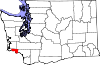 | |
| CDPs | ||
| Other communities | ||
This Wahkiakum County, Washington state location article is a stub. You can help Wikipedia by expanding it. |