Russell, Pennsylvania
Russell, Pennsylvania | |
|---|---|
Unincorporated community and census-designated place | |
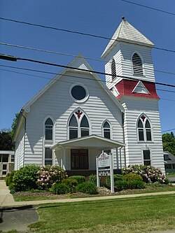
 The Russell United Methodist Church | |
| Coordinates: 41°56′29″N 79°8′6″W / 41.94139°N 79.13500°W | |
| Country | United States |
| State | Pennsylvania |
| County | Warren |
| Elevation | 1,250 ft (380 m) |
| Time zone | UTC-5 (Eastern (EST)) |
| • Summer (DST) | UTC-4 (EDT) |
| GNIS feature ID | 1198199[1]2631301[2] |
Russell is an unincorporated community and census-designated place in Pine Grove Township, Warren County, Pennsylvania, United States. The community is east of Lander and lies at the intersection of U.S. Route 62 and Pennsylvania Route 957. It is drained by Conewango Creek. As of the 2010 census the population was 1,408.[citation needed]
-
Keystone marker
References
Wikimedia Commons has media related to Russell, Pennsylvania.


