Sävar
Appearance
Sävar | |
|---|---|
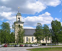
 Sävar Church in June 2007 | |
| Country | Sweden |
| Province | Västerbotten |
| County | Västerbotten County |
| Municipality | Umeå Municipality |
| Area | |
| • Total | 2.45 km2 (0.95 sq mi) |
| Population (31 December 2010)[1] | |
| • Total | 2,670 |
| • Density | 1,092/km2 (2,830/sq mi) |
| Time zone | UTC+1 (CET) |
| • Summer (DST) | UTC+2 (CEST) |
Sävar is a locality situated in Umeå Municipality, Västerbotten County, Sweden with 2,670 inhabitants in 2010.[1]
It is located by E4 about 15 km north of Umeå, Sweden. Sävar is mostly known for being the last battlefield of the Finnish War.
References
- ^ a b c "Tätorternas landareal, folkmängd och invånare per km2 2005 och 2010" (in Swedish). Statistics Sweden. 14 December 2011. Archived from the original on 10 January 2012. Retrieved 10 January 2012.
{{cite web}}: Unknown parameter|deadurl=ignored (|url-status=suggested) (help)
