San Cristóbal de las Casas National Airport
San Cristóbal de las Casas National Airport Aeropuerto Nacional de San Cristóbal de las Casas | |||||||||||
|---|---|---|---|---|---|---|---|---|---|---|---|
| Summary | |||||||||||
| Airport type | Public | ||||||||||
| Operator | Aeropuertos y Servicios Auxiliares (ASA)(Until 2010) | ||||||||||
| Serves | San Cristóbal de las Casas, Chiapas, Mexico | ||||||||||
| Elevation AMSL | 7,185 ft / 2,189 m | ||||||||||
| Coordinates | 16°41′24″N 092°31′48″W / 16.69000°N 92.53000°W | ||||||||||
 | |||||||||||
| Runways | |||||||||||
| |||||||||||
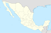
San Cristóbal de las Casas National Airport (Template:Lang-es) formerly (IATA: SZT, ICAO: MMSC) was an airport located 18 kilometres (11 mi) from the city of San Cristóbal de las Casas in the state of Chiapas, Mexico. It was operated by Aeropuertos y Servicios Auxiliares (Template:Lang-en), a corporation of the federal government. It was also known as Corazón de María Airport.[1]
The airport covered an area of 165 hectares (410 acres) and had a 2.6 kilometres (1.6 mi) long runway, making it suitable for landing Boeing 737 or McDonnell Douglas DC-9-32 aircraft. In 2009, it served 1,249 passengers.[1] This airport was little used because the Angel Albino Corzo International Airport (serving Tuxtla Gutierrez) is located only 50 minutes away.
The Airport was closed in July 2010 due to structural terrain failures.
References
- ^ a b c Aeropuerto de San Cristóbal de las Casas at ASA website
- ^ Template:WAD
- ^ Airport information for SZT at Great Circle Mapper. Source: DAFIF (effective October 2006).
External links

