Santa Elena de Uairén Airport
Appearance
Santa Elena de Uairén Airport Aeropuerto de Santa Elena de Uairén | |||||||||||
|---|---|---|---|---|---|---|---|---|---|---|---|
| Summary | |||||||||||
| Airport type | Public | ||||||||||
| Operator | Government | ||||||||||
| Serves | Santa Elena de Uairén, Venezuela | ||||||||||
| Elevation AMSL | 2,939 ft / 896 m | ||||||||||
| Coordinates | 04°33′17″N 061°08′41″W / 4.55472°N 61.14472°W | ||||||||||
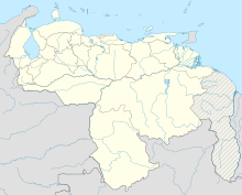
| Map | |||||||||||
 | |||||||||||
| Runways | |||||||||||
| |||||||||||
Santa Elena de Uairén Airport (Template:Lang-es) (IATA: SNV, ICAO: SVSE) is an airport serving Santa Elena de Uairén,[1] a city in the Venezuelan state of Bolívar.
The airport was under renovation in 2008[3] and it was re-opened on 29 April 2009 by Venezuelan President Hugo Chavez.
Facilities
The airport resides at an elevation of 2,939 feet (896 m) above mean sea level. It has one runway designated 11/29 with an asphalt surface measuring 1,660 by 30 metres (5,446 ft × 98 ft).[1]
Airlines and destinations
| Airlines | Destinations |
|---|---|
| Aereotuy | Porlamar |
References
- ^ a b c Airport information for SVSE from DAFIF (effective October 2006)
- ^ Airport information for SNV at Great Circle Mapper. Source: DAFIF (effective October 2006).
- ^ "Aeropuerto de Santa Elena listo para su inauguración" (in Spanish). Gobernación del Estado Bolívar. 27 August 2008.
External links

