Selebar

Coordinates: 3°54′17″S 102°19′13″E / 3.90472°S 102.32028°E / -3.90472; 102.32028
From Wikipedia, the free encyclopedia

This is an old revision of this page, as edited by JJMC89 bot (talk | contribs) at 09:40, 26 March 2017 (Migrate {{Infobox settlement}} coordinates parameters to {{Coord}}, see Wikipedia:Coordinates in infoboxes). The present address (URL) is a permanent link to this revision, which may differ significantly from the current revision.

Selebar
Kecamatan and town
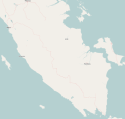
Selebar is located in Southern Sumatra
Selebar
Selebar
Location of the town in southern Sumatra
Coordinates: 3°54′17″S 102°19′13″E / 3.90472°S 102.32028°E / -3.90472; 102.32028
Country Indonesia
RegionSumatra
ProvinceBengkulu Province

Selebar is a small port town on the south-west coast of Sumatra, Indonesia. It is located several kilometres south of Bengkulu City and is noted for its large harbor. Administratively, Selebar forms a kecamatan of Bengkulu Province.