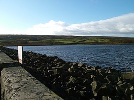
Selset Reservoir
Appearance
This article relies largely or entirely on a single source. (January 2016) |
| Selset Reservoir | |
|---|---|
 Selset Reservoir | |
| Location | County Durham, England |
| Coordinates | 54°35′6″N 2°8′6″W / 54.58500°N 2.13500°W |
| Type | Reservoir |
| Primary inflows | River Lune |
| Primary outflows | River Lune |
| Managing agency | Northumbrian Water |
| Surface elevation | 310 m (1,020 ft) |
Selset Reservoir is a reservoir in County Durham, England. It is situated in the Lune Valley which is a side valley of the River Tees, about 5 miles (8 km) west of Middleton-in-Teesdale. It supplies water for Teesdale and is owned by Northumbrian Water. It was built in 1960 and its main use (apart from water supply) is sailing.
See also
