Sheep's Head
Appearance
51°32′24″N 9°51′03″W / 51.54000°N 9.85083°W


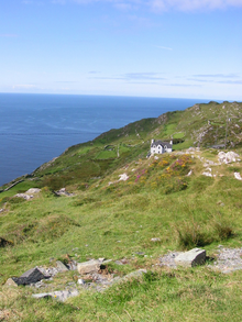
Sheep's Head, also known as Muntervary (Template:Lang-ga), is the headland at the end of the peninsula between Bantry Bay and Dunmanus Bay in County Cork, Ireland.
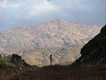
The Sheep's Head Way is an 88 km long-distance trail which follows old tracks and roads around the peninsula from Bantry to the headland and back. The trail is very accessible and is well signposted (see image on right). The trail is divided into eight stages—each representing a half-day's walking.
Among those responsible for establishing the Way was Tom Whitty, an American.
The peninsula has three villages, Durrus (six miles from Bantry), Ahakista (twelve miles from Bantry), and Kilcrohane (sixteen miles from Bantry)
Archaeology
Durrus
- Boulder Burial, Ballycomane
- Burial Ground, Brahalish, Clashadoo, Coolcoulaghta, Dunbeacon, Kilvenogue,
- Cairn, Coolcoulaghta, Moulinward
- Castle, Dunbeacon
- Church, Moulinward (In repair 1639 ruins 1699)
- Fulacht Fiadha (Cooking Pit), Dunbeacon,Celtic Iron Age 600 B.C.-400 A.D.
- Graveyard, Moulinward
- Holy Well, Dunbeacon
- Mill Stone, Brahalish
- Promontory fort, Coolcoulaghta (Celtic Iron Age 600 B.C.-400 A.D.)
- Ring forts, Ballycomane, Brahalish, Clonee, Drumtahaneen, Dunbeacon, Gortyalassa, Kealties, Rushineska,Celtic Iron Age 600 B.C.-400 A.D.
- Shell Midden, Dunbeacon
- Standing Stones (Gallauns), Ballycomane, Coolcoulaghta (Stone Pair bronze age 2200B.C.-600B.C., Kealties, Parkana
- Stone Row, Moulinward,Bronze age 2200B.C.-600B.C.
- Stone Circle, Dunbeacon (Bronze age 2200B.C.-600B.C.) [1], [2]
- Tower House (medieval post 1200A.D.), Rossmore (O'Mahony|McCarthy?)
Kilcrohane
- Ardahill, Ardintenant, Caher, Caheragh, Derrycluvane, Drumnea, Faunmore, Gortalassa, Gortaneish, Killoveenogue , Knockroe, Raferigeen, Letter East, Rossnacaheragh , Tullig Ringfort Celtic Iron Age 600 B.C. - 400 A.D.
- Aughaleigue, Gouladoo, Laherandota, Letter East, Holy well
- Ballytransna, Kilcrohane, Cashel
- Ardaneig, Caher, Farranamanagh, Gortnakilla, Killonoveenogue, Letter West, Kilcrohane, Burial Ground,
- Caherurlagh, Holed Stone for healing
- Dooneen, Galladoo, Keelovenogue, Promontory Fort Celtic Iron Age 600 b.c. - 400 A.D.
- Dromnea, Bardic School Medieval post 1200 A.D., Ornamental Tower erected Lord Bandon, Holy Well (tober na nduanairidhe well of the poets), possible fulach fiadh
- Farranmanagh, Stone Row Bronze Age, Children's Burial Ground, Souterrain, Tower house (O'Daly), Gallaun (standing stone
- Gouladoo, Holy Well
- Letter West, Children's Burial Ground
- Kilcrohane, Souterrain
- Signal Towers, Tooreen
Townlands of Peninsula
Durrus
- Ahagouna Ath Gamhna, 'Ford of the calves'
- Ardogeena Ard na Gaoine, 'height of the flint stones'
- Ballycomane Baile an Chumain 'town of the little valley'
- Boolteenagh Buailtenach, 'summer pasture'
- Brahalish Breach Lios, 'spotted forts'
- Carrigboy Carraig Buidhe, 'yellow rock'
- Curraghavaddra Currach an Mhadra, 'the bog of the dog'
- Clonee Cluain Fhia, 'meadow of the deer'
- Clashadoo Claiseanna Dubha, 'dark hollows'
- Coolcoulaghta Cul Cabhlachta, 'remote place of the ruins'
- Coomkeen Cum Caion, 'gentle valley'
- Crottees Cruiteanna, 'humpy ridges'
- Dromreagh Drom Riabhach, 'striped ridge'
- Dromataniheen
- Dromreague Drom Reidh, 'evev ridge'
- Dunmanus Dun Manus, 'fort of Manus'
- Durrus Dubh Ros, 'dark wooded promontory'
- Gearhameen Gaortha min, 'small wodded glen'
- Gurteen Goirtin 'small field'
- Kealties Caola, 'narrow strip of land'
- Kiloveenoge Cill Ui Mhionoig', 'Minogue's church, child burial ground
- Lissareemig
- Mannions Island Large and Small
- Moulivarde Meall an Bhaird, 'the bard's knoll'
- Mullagh ''Mullagh, 'summit'
- Murreagh Muirioch, 'seaside marsh'
- Parkana Pairceanna, 'fields'
- Rooska Riasca, 'marshes'
- Rossmore Ros Mor 'large copse'
- Rusheenasisks Roisin an Uisce, 'little copse of the water'
- Teadagh Taodach, 'rugged land'
- Tullig Tullach, 'mound'
Kilcrohane
- Ahileague, Achadh na Liag (field of the boulders or flagstones|rocking-stone)
- Ardahill, Ard Athchoill (High new wood| possible connection to St.Eochaile)
- Ardanenig, (Ard an Aonaigh (height of the fair or assembly place)
- Ballieragh, Baile Iartharach (western townland)
- Ballyruin, Baile Ui Tuain (Ruane's townland)
- Ballintra, Baile na dTra (townland of the strands)
- Caher, Cathair (stone fort)
- Cahergal, Cathair Gheal (white fort)
- Caherurlagh, Cathair Iolrach (eagle fort)
- Clash, Clais (hollow)
- Carrivaleen, Cathair an Mhillin (stone fort of the knoll)
- Cora, subdivision of Ballyruin
- Derrycluvane, Doire Clumhanta (remote oak grove)
- Dooneen, Duinin (little fort)
- Doonour, Dub Amhair (fort of music)
- Dromnea, Drom an Fhiaidh (ridge of the deer)
- Eskeraha, Eascracha (glacier ridge)
- Fahane, Faithchean (small green plot)
- Farranamanagh, Lower, Upper, Fearann na Mannach (monk's land)
- Fawnmore, Fan Mor (big slope)
- Foilbeag,
- Galladoo, Gabhla Dubha (dark forks|black hill shoulders)
- Gearhies, Gaorthai (wodded glens)
- Glanalin, Gleann na Linn (glen of the pools)
- Glanroon, Gleann rúin (glen of secrets)
- Gortnalassa, Gort an Leasa (fort field)
- Gortaneish, Gort an Ois (field of the fawn)
- Gortnakilla, Gort na Cille (field of the church)
- Gurtfahane, Gort Fahane (field of the thistle)
- Gortavallig, Gort an Bhealaigh (roadside field)
- Kilcrohane, Cill Crochain (Crohane's church)
- Killeen, Cillin (little church)
- Knockeens, Cnoichini (small hills)
- Knockroe, Cnoc Ruadh (red hills)
- Laherndotia, Leath Fhearann Doite (burned settlement side)
- Letter East, Lower, West, Leitir (wet hillside)
- Moulnaskeha, Meall na Sceithe (knoll of the bush)
- Raffrigeen, Rath Aimhirgin (aimhirgin's fort)
- Reennacappul, Rinn na gCapall (horses point)
- Rhea, (mountain flat or plateau)
- Rhearour, Rinn Reamhar (broad point)
- Rosskerrig, Ros na gCaorach (wodded promontory of the sheep)
- Rossnacaheragh, Ros na cathrach (copse of the fort)
- Tooreen, Tuairin (grassland|little drying or bleaching place)
- The Paddock
- Tullig, Tullach (mound)
Natural history
- Owen's Island c. 1 hectare
- Sheep's Head, Costal heathland includes rare plants Viola lactea (Pale Dog Violet), Tuberaria (Spotted Rock Rose) and also has choughs and fulmars
Bibliography
- Donald Grant (lived in Dooneen), White Goats and Black Bees. (Editions: New York: Doubleday, 1974 ISBN 0-385-06522-1; London: Joseph, 1975 ISBN 0-7181-1294-6; Schull: Mizen Books, 1990 ISBN 0-911797-86-6)
- Barry Keane: The Beara, Sheep's Head, and Mizen Peninsulas: 40 walks and scrambles. Cork: Collins Press, 1997. 87 p. ISBN 1-898256-29-2
- Wolfgang Keller: Off the beaten track: the Sheep's Head Way as an example of rural tourism in the South West of Ireland. University of Goettingen (Germany), 2003. 128 p. (Dipoloma thesis)
- Ann McCarthy: Under the Shadow of Seefin. 2001
- Frank O'Mahony: Kilcrohane. (Book 1: Kilcrohane - the Holy Ground -- Book 2: O'Mahony - the diary of Frank). Dromkeal: Frank O'Mahony, 1990. 148 p.
- Westropp, Thomas Johnson: Fortified headlands and castles in western County Cork. Vol. 1: From Cape Clear to Dunmanus Bay. Dublin, 1915. (Proceedings of the Royal Irish Academy / C. Vol. 32, no. 17)
See also
External links
- Walk Ireland Official site of the Waymarked Ways of Ireland with map of Sheep's Head Way
- Guided hill walks on the Sheep's Head
