Sheffield, Alabama
Sheffield, Alabama | |
|---|---|
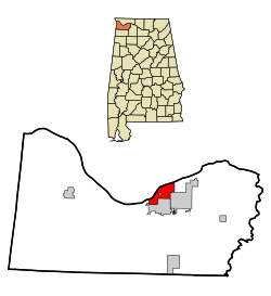
 Location in Colbert County and the state of Alabama | |
| Country | United States |
| State | Alabama |
| County | Colbert |
| Area | |
| • Total | 6.6 sq mi (17.1 km2) |
| • Land | 6.6 sq mi (17 km2) |
| • Water | 0 sq mi (0.1 km2) |
| Elevation | 515 ft (157 m) |
| Population (2000) | |
| • Total | 9,652 |
| • Density | 1,462.4/sq mi (564.4/km2) |
| Time zone | UTC-6 (Central (CST)) |
| • Summer (DST) | UTC-5 (CDT) |
| ZIP code | 35660 |
| Area code | 256 |
| FIPS code | 01-69648 |
| GNIS feature ID | 0153401 |
| Website | http://www.sheffieldalabama.org/ |
Sheffield is a city in Colbert County, Alabama, United States, and is included in The Shoals MSA. As of the 2000 census, the population of the city is 9,652. Sheffield is the birthplace of notable attorney, actor, former senator and presidential contender Fred Thompson. It is also home to the Muscle Shoals Sound Studio where many popular twentieth century musicians recorded their work.
Geography
Sheffield is located at 34°45′35″N 87°41′41″W / 34.75972°N 87.69472°WInvalid arguments have been passed to the {{#coordinates:}} function (34.759721, -87.694592)Template:GR.
According to the U.S. Census Bureau, the city has a total area of 6.6 square miles (17.1 km²), of which, 6.6 square miles (17.0 km²) of it is land and 0.04 square miles (0.1 km²) of it (0.46%) is water.
Sheffield was the home of Muscle Shoals Sound Studios at 3614 Jackson Avenue and later at 1000 Alabama Avenue. Cher, The Rolling Stones, Aretha Franklin, Bob Seger, Lynyrd Skynyrd, Simon & Garfunkle, The Staple Singers, Joe Cocker and many others recorded the biggest hits of their careers in this small studio, that remains well known and respected throughout the music industry.
Sheffield, at the Spring Creek boat launch and park area was also recognized as one of the Colbert County sites of embarkation, by riverboat and barge from the southern side of the Tennessee River en route to Waterloo, Alabama, on the north side, during the historical relocation of Eastern and Southern United States Indian Tribes, known as "The Trail Of Tears".
Demographics
| Census | Pop. | Note | %± |
|---|---|---|---|
| 1890 | 2,751 | — | |
| 1900 | 3,333 | 21.2% | |
| 1910 | 4,865 | 46.0% | |
| 1920 | 6,682 | 37.3% | |
| 1930 | 6,221 | −6.9% | |
| 1940 | 7,933 | 27.5% | |
| 1950 | 10,767 | 35.7% | |
| 1960 | 13,491 | 25.3% | |
| 1970 | 13,115 | −2.8% | |
| 1980 | 11,903 | −9.2% | |
| 1990 | 10,380 | −12.8% | |
| 2000 | 9,652 | −7.0% | |
| 2007 (est.) | 9,174 |
As of the censusTemplate:GR of 2000, there were 9,652 people, 4,243 households, and 2,711 families residing in the city. The population density was 1,471.4 people per square mile (568.1/km²). There were 4,760 housing units at an average density of 725.6/sq mi (280.2/km²). The racial makeup of the city was 71.21% White, 26.21% Black or African American, 0.39% Native American, 0.28% Asian, 0.04% Pacific Islander, 0.57% from other races, and 1.30% from two or more races. 1.50% of the population were Hispanic or Latino of any race.
There were 4,243 households out of which 27.2% had children under the age of 18 living with them, 43.3% were married couples living together, 16.7% had a female householder with no husband present, and 36.1% were non-families. 32.5% of all households were made up of individuals and 15.5% had someone living alone who was 65 years of age or older. The average household size was 2.27 and the average family size was 2.87.
In the city the population was spread out with 23.7% under the age of 18, 8.0% from 18 to 24, 26.6% from 25 to 44, 22.6% from 45 to 64, and 19.0% who were 65 years of age or older. The median age was 39 years. For every 100 females there were 85.5 males. For every 100 females age 18 and over, there were 80.6 males.
The median income for a household in the city was $26,673, and the median income for a family was $33,877. Males had a median income of $30,378 versus $18,033 for females. The per capita income for the city was $16,022. About 16.5% of families and 18.7% of the population were below the poverty line, including 27.5% of those under age 18 and 10.4% of those age 65 or over.

