Shell River (Saskatchewan)
| Shell River | |
|---|---|
 North Saskatchewan River drainage basin | |
| Location | |
| Country | |
| Province | |
| Physical characteristics | |
| Source | Big Shell Lake |
| • location | RM of Spiritwood No. 496 |
| • coordinates | 53°13′43″N 107°08′55″W / 53.2287°N 107.1487°W |
| • elevation | 578 m (1,896 ft) |
| Mouth | Sturgeon River |
• location | RM of Buckland No. 491 |
• coordinates | 53°20′58″N 106°00′01″W / 53.3494°N 106.0003°W |
| Basin features | |
| River system | Sturgeon River |
| Tributaries | |
| • left | Sucker Creek |
| • right | Mistawasis Creek |
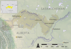
Shell River,[1] formerly Shell Brook,[2] is a river in the north-central region of the Canadian province of Saskatchewan. The river begins at Big Shell Lake and travels in an easterly direction and flows into the Sturgeon River north of the city of Prince Albert. The upper reaches of its watershed are as far west as the Thickwood Hills.[3]
Course
[edit]Shell River begins in the RM of Spiritwood No. 496 at the north end of Big Shell Lake[4] and flows north for about three kilometres before emptying into Little Shell Lake.[5] From Little Shell Lake, the river carries on north-east past Memorial Lake Regional Park and the village of Shell Lake. From Shell Lake, the Shell River heads north towards Big River 118A Indian reserve and then loops back down south passing through Ahtahkakoop 104 Indian reserve where it begins heading in an eastward direction. Along this leg of the route, it is joined by several tributaries, enters the RM of Shellbrook No. 493, and passes by the community of Shellbrook, which took its name from the river.[6] From Shellbrook, Shell River continues eastward and meets with the Sturgeon River in the RM of Buckland No. 491. The Sturgeon River carries on southward and joins the North Saskatchewan River[7] on the west side of Prince Albert.
Tributaries
[edit]The following are the tributaries of Shell River from its headwaters at Shell Lake to its mouth at Sturgeon River:
- Mistowasis Creek
- Tippicanoe Creek
- Vant Creek
- Sucker Creek
See also
[edit]References
[edit]- ^ Welch, Deborah; Payne, Michael (23 September 2012). "Shellbrook". The Canadian Encyclopedia. The Canadian Encyclopedia. Retrieved 7 September 2022.
- ^ "Shell Brook". Canadian Geographical Names Database. Government of Canada. Retrieved 7 September 2022.
- ^ "Thickwood Hills". Canadian Geographical Names Database. Government of Canada. Retrieved 12 September 2022.
- ^ "Big Shell Lake Fishing Map". GPS Nautical Charts. Bist LLC. Retrieved 7 September 2022.
- ^ "Little Shell Lake". Canadian Geographical Names Database. Government of Canada. Retrieved 7 September 2022.
- ^ McLennan, David. "Shellbrook". the Encyclopedia of Saskatchewan. University of Regina. Retrieved 7 September 2022.
- ^ Oegema, Bart. "North Saskatchewan River". ESask. University of Regina. Retrieved 6 May 2024.


