Sherburn Hill
Appearance
| Sherburn Hill | |
|---|---|
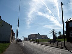
 Front Street, looking east | |
 View to the west downhill towards Sherburn and Durham city | |
| OS grid reference | NZ335421 |
| Shire county | |
| Region | |
| Country | England |
| Sovereign state | United Kingdom |
| Dialling code | 0191 |
| Police | Durham |
| Fire | County Durham and Darlington |
| Ambulance | North East |
| UK Parliament | |
Sherburn Hill is a village in County Durham, in England. It is situated to the east of Sherburn.
From 1835 to 1965, the Sherburn Hill Colliery operated near the village. In 1851, the Ebenezer Primitive Methodist Church was established in Sherburn Hill. Since the merger with the nearby Bethel Wesleyan Methodist Church in 1968, the church has been called the Sherburn Hill Methodist Church.
References
External links
Wikimedia Commons has media related to Sherburn Hill.
54°46.3′N 1°28.4′W / 54.7717°N 1.4733°W
