Sherman Island (Antarctica)
Appearance
| Geography | |
|---|---|
| Location | Antarctica |
| Coordinates | 72°40′S 99°45′W / 72.667°S 99.750°W |
| Length | 59 km (36.7 mi) |
| Width | 19 km (11.8 mi) |
| Administration | |
None | |
| Demographics | |
| Population | Uninhabited |


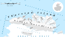
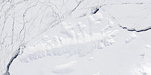
Sherman Island is an ice-covered island of Antarctica about 59 kilometres (32 nmi) long and 19 kilometres (10 nmi) wide, lying south of Thurston Island in the middle of Peacock Sound. The feature rises above the Abbot Ice Shelf which occupies the sound.
Delineated from aerial photographs taken by US Navy Operation Highjump in December 1946. Named by US-ACAN for Admiral Forrest Sherman, USN, Chief of Naval Operations, 1949–51, when preparations were being made for U.S. Naval support during the forthcoming International Geophysical Year (IGY) operations.
Maps
- Thurston Island – Jones Mountains. 1:500000 Antarctica Sketch Map. US Geological Survey, 1967.
- Antarctic Digital Database (ADD). Scale 1:250000 topographic map of Antarctica. Scientific Committee on Antarctic Research (SCAR), 1993–2016.
See also
- Composite Antarctic Gazetteer
- List of Antarctic and sub-Antarctic islands
- List of Antarctic islands south of 60° S
- SCAR
- Territorial claims in Antarctica
References
![]() This article incorporates public domain material from "Sherman Island (Antarctica)". Geographic Names Information System. United States Geological Survey.
This article incorporates public domain material from "Sherman Island (Antarctica)". Geographic Names Information System. United States Geological Survey.
External links

