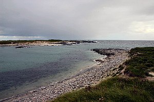
Sibhinis

Sibhinis, Siobhanais [1] or Shivinish.[1][2] is one of the Monach Islands, lying between Ceann Iar and Ceann Ear. It is tidal, and connected at low tide to Ceann Iar by Fadhail Shibhinis, and to Ceann Ear by Faodhail Chinn Ear. It is 16 metres (52 feet) at its highest point. It is said that it was at one time possible to walk all the way to Baleshare, and on to North Uist, five miles (8 km) away at low tide. In the 16th century, a large tidal wave was said to have washed this[what?] away.[2]
The island is about 22 hectares (54 acres) acres in extent.[3]
References
- ^ a b Machair Marooned Offshore/ Machair aig Muir http://www.snh.org.uk/publications/on-line/designatedareas/nnrs/monachisles/monach.asp
- ^ a b Haswell-Smith, Hamish. (2004) The Scottish Islands. Edinburgh. Canongate.
- ^ Rick Livingstone’s Tables of the Islands of Scotland (pdf) Argyll Yacht Charters. Retrieved 12 Dec 2011.
Wikimedia Commons has media related to Sibhinis.
57°31′20″N 7°38′05″W / 57.52222°N 7.63472°W
