
Stanley, Idaho
Stanley, Idaho | |
|---|---|
 Stanley in June 2009 | |
 Location in Custer County and the state of Idaho | |
| Country | United States |
| State | Idaho |
| County | Custer |
| Government | |
| • Mayor | Herb Mumford (2010- ) |
| Area | |
| • Total | 0.62 sq mi (1.61 km2) |
| • Land | 0.61 sq mi (1.58 km2) |
| • Water | 0.01 sq mi (0.03 km2) |
| Elevation | 6,253 ft (1,906 m) |
| Population | |
| • Total | 63 |
| • Estimate (2012[3]) | 67 |
| • Density | 103.3/sq mi (39.9/km2) |
| Time zone | UTC-7 (Mountain MST) |
| • Summer (DST) | UTC-6 (MDT) |
| ZIP code | 83278 |
| Area code | 208 |
| FIPS code | 16-76780 |
| GNIS feature ID | 0398179 |
| Website | stanley.id.gov |
Stanley is a city in Custer County, Idaho, United States. The population was 63 at the 2010 census; down from 100 in 2000. The center of population of Idaho in 2000 was located in Stanley.[4]
History
Fur trappers of the Hudson's Bay Company discovered the Stanley Basin in the 1820s, but it was mostly avoided due to scarcity of beaver. Captain John Stanley, a Civil War veteran, led a party of prospectors through the area in 1863 (or 1864), but they found little gold and moved on and discovered the Atlanta lode on the south end of the Sawtooths. The site was not considered a town until 1919 when its streets and lots were surveyed and recorded.[5]
A 2003 memoir by John Rember, Traplines: Coming Home to the Sawtooth Valley describes life in Stanley and its surrounding area, and the cultural changes connected to the establishment of the Sawtooth National Recreation Area.[6]
Geography
Stanley is located at 44°13′0″N 114°56′16″W / 44.21667°N 114.93778°W (44.216698, -114.937814),Template:GR at an elevation of 6,253 feet (1,906 m) above sea level.[7]
According to the United States Census Bureau, the city has a total area of 0.62 square miles (1.61 km2), of which, 0.61 square miles (1.58 km2) is land and 0.01 square miles (0.03 km2) is water.[1] Stanley is surrounded by the Sawtooth National Recreation Area.
Demographics
| Census | Pop. | Note | %± |
|---|---|---|---|
| 1910 | 75 | — | |
| 1920 | 155 | 106.7% | |
| 1930 | 159 | 2.6% | |
| 1940 | 158 | −0.6% | |
| 1950 | 33 | −79.1% | |
| 1960 | 35 | 6.1% | |
| 1970 | 47 | 34.3% | |
| 1980 | 99 | 110.6% | |
| 1990 | 71 | −28.3% | |
| 2000 | 100 | 40.8% | |
| 2010 | 63 | −37.0% | |
| source:[8][9] | |||
2010 census
As of the census[2] of 2010, there were 63 people, 30 households, and 13 families residing in the city. The population density was 103.3 inhabitants per square mile (39.9/km2). There were 91 housing units at an average density of 149.2 per square mile (57.6/km2). The racial makeup of the city was 100.0% White.
There were 30 households of which 3.3% had children under the age of 18 living with them, 40.0% were married couples living together, 3.3% had a male householder with no wife present, and 56.7% were non-families. 40.0% of all households were made up of individuals and 6.7% had someone living alone who was 65 years of age or older. The average household size was 1.73 and the average family size was 2.23.
The median age in the city was 52.5 years. 3.2% of residents were under the age of 18; 1.6% were between the ages of 18 and 24; 23.8% were from 25 to 44; 58.7% were from 45 to 64; and 12.7% were 65 years of age or older. The gender makeup of the city was 52.4% male and 47.6% female.
2000 census
As of the censusTemplate:GR of 2000, there were 100 people, 45 households, and 23 families residing in the city. The population density was 161.0 people per square mile (62.3/km²). There were 77 housing units at an average density of 124.0 per square mile (48.0/km²). The racial makeup of the city was 98.00% White, 1.00% Native American, and 1.00% from two or more races. Hispanic or Latino of any race were 1.00% of the population.

from Lower Stanley in June 2008
There were 45 households out of which 24.4% had children under the age of 18 living with them, 51.1% were married couples living together, 2.2% had a female householder with no husband present, and 46.7% were non-families. 33.3% of all households were made up of individuals and none had someone living alone who was 65 years of age or older. The average household size was 2.22 and the average family size was 3.00.
In the city the population was spread out with 24.0% under the age of 18, 6.0% from 18 to 24, 27.0% from 25 to 44, 40.0% from 45 to 64, and 3.0% who were 65 years of age or older. The median age was 39 years. For every 100 females there were 122.2 males. For every 100 females age 18 and over, there were 123.5 males.
The median income for a household in the city was $37,813, and the median income for a family was $45,625. Males had a median income of $25,000 versus $37,500 for females. The per capita income for the city was $23,303. There were 25.9% of families and 21.4% of the population living below the poverty line, including 47.1% of under eighteens and none of those over 64.
Government
In November 2005, residents elected 22 year-old Hannah Stauts as mayor of Stanley. Stauts, a former resident of Boise, was the youngest female mayor in the United States. The current mayor is Herb Mumford, a retired engineer who was elected in November 2009.[10]
Major highways
 SH-21 - Ponderosa Pine Scenic Byway
 SH-75 - Sawtooth Scenic Byway (southbound), Salmon River Scenic Byway (northbound)
Climate
Stanley has an alpine subarctic climate with very cold winters and warm summers with a very large diurnal temperature variation, especially in summer. Frosts can occur at any time of the year. There are on average 290 days in the year with frost (10 of them in July) and 60 nights that reach 0 °F (−18 °C).[11]
| Stanley, Idaho | ||||||||||||||||||||||||||||||||||||||||||||||||||||||||||||
|---|---|---|---|---|---|---|---|---|---|---|---|---|---|---|---|---|---|---|---|---|---|---|---|---|---|---|---|---|---|---|---|---|---|---|---|---|---|---|---|---|---|---|---|---|---|---|---|---|---|---|---|---|---|---|---|---|---|---|---|---|
| Climate chart (explanation) | ||||||||||||||||||||||||||||||||||||||||||||||||||||||||||||
| ||||||||||||||||||||||||||||||||||||||||||||||||||||||||||||
| ||||||||||||||||||||||||||||||||||||||||||||||||||||||||||||
| Climate data for Stanley, Idaho (1961–1990) | |||||||||||||
|---|---|---|---|---|---|---|---|---|---|---|---|---|---|
| Month | Jan | Feb | Mar | Apr | May | Jun | Jul | Aug | Sep | Oct | Nov | Dec | Year |
| Record high °F (°C) | 55 (13) |
65 (18) |
64 (18) |
77 (25) |
84 (29) |
91 (33) |
98 (37) |
97 (36) |
89 (32) |
84 (29) |
66 (19) |
63 (17) |
98 (37) |
| Mean daily maximum °F (°C) | 26.5 (−3.1) |
33.1 (0.6) |
41.7 (5.4) |
49.7 (9.8) |
59.6 (15.3) |
68.1 (20.1) |
78.5 (25.8) |
77.7 (25.4) |
68.3 (20.2) |
56.3 (13.5) |
38.7 (3.7) |
26.1 (−3.3) |
52.0 (11.1) |
| Mean daily minimum °F (°C) | −1 (−18) |
0.3 (−17.6) |
8.7 (−12.9) |
19.6 (−6.9) |
27.6 (−2.4) |
33.2 (0.7) |
35.6 (2.0) |
32.9 (0.5) |
27.1 (−2.7) |
20.9 (−6.2) |
12.2 (−11.0) |
−0.4 (−18.0) |
18.1 (−7.7) |
| Record low °F (°C) | −46 (−43) |
−47 (−44) |
−34 (−37) |
−18 (−28) |
8 (−13) |
12 (−11) |
15 (−9) |
12 (−11) |
1 (−17) |
−10 (−23) |
−30 (−34) |
−54 (−48) |
−54 (−48) |
| Average precipitation inches (mm) | 1.62 (41) |
1.32 (34) |
1.13 (29) |
1.03 (26) |
1.21 (31) |
1.17 (30) |
0.59 (15) |
0.62 (16) |
0.77 (20) |
0.93 (24) |
1.52 (39) |
1.58 (40) |
13.49 (345) |
| Average snowfall inches (cm) | 17.0 (43) |
14.1 (36) |
11.2 (28) |
3.9 (9.9) |
1.0 (2.5) |
0.1 (0.25) |
0 (0) |
0 (0) |
0.3 (0.76) |
1.8 (4.6) |
10.2 (26) |
15.4 (39) |
75 (190.01) |
| Source: NOAA,[12] | |||||||||||||
Gallery
-
 Stanley from above
 -
 Stanley Post Office (83278)
 -
 Chapel
 -
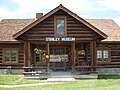 Museum


References
- ^ a b "US Gazetteer files 2010". United States Census Bureau. Retrieved 2012-12-18.
- ^ a b "American FactFinder". United States Census Bureau. Retrieved 2012-12-18.
- ^ "Population Estimates". United States Census Bureau. Retrieved 2013-06-03.
- ^ census.gov - state centers of population - 2000 - accessed 2011-12-10
- ^ "Idaho for the Curious", by Cort Conley, ©1982, ISBN 0-9603566-3-0, p.188-189
- ^ Rember, John (2003). Traplines: coming home to Sawtooth Valley (1st Pantheon ed ed.). New York: Pantheon Books. ISBN 0375422072.
{{cite book}}:|edition=has extra text (help) - ^ U.S. Geological Survey Geographic Names Information System: Stanley, Idaho
- ^ Moffatt, Riley. Population History of Western U.S. Cities & Towns, 1850-1990. Lanham: Scarecrow, 1996, 98.
- ^ "Subcounty population estimates: Idaho 2000-2007" (CSV). United States Census Bureau, Population Division. 2009-03-18. Retrieved 2009-04-27.
- ^ stanley.id.gov - city officials - accessed 2011-12-10
- ^ "Period of Record General Climate Summary - Temperature - NOAA". NOAA.
- ^ a b "STANLEY, IDAHO- Climate Summary". NOAA.
Further reading
- Yarber, Ester; McGowan, Edna (1998). "STANLEY-SAWTOOTH COUNTRY". Caldwell, Idaho: Caxton Printers LTD.
{{cite journal}}: Cite journal requires|journal=(help)
External links
- Official website - City of Stanley
- Stanley/Sawtooth Chamber of Commerce
- Sawtooth Camera - webcam - Stanley & Sawtooths
Municipalities and communities of Custer County, Idaho, United States | ||
|---|---|---|
| Cities |  | |
| Unincorporated communities | ||
| Ghost towns | ||