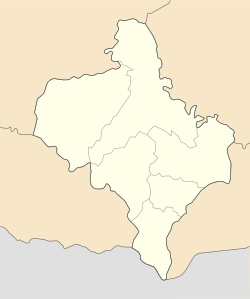
Stari Bohorodchany
Appearance
Stari Bohorodchany
Старі Богородчани | |
|---|---|
 Church of the Nativity of the Theotokos in Stari Bohorodchany | |
| Coordinates: 48°49′50″N 24°31′12″E / 48.83056°N 24.52000°E | |
| Country | |
| Oblast | |
| Raion | Ivano-Frankivsk Raion |
| First mentioned | 16 January 1441 |
Stari Bohorodchany (Ukrainian: Старі Богородчани; Polish: Bohorodczany Stare) is a village in Ivano-Frankivsk Oblast, Ukraine, located in Ivano-Frankivsk Raion. It is the administrative centre of Stari Bohorodchany rural hromada.[1]
History
[edit]The first mention of Stari Bohorodchany is in a Polish government act dating to 16 January 1441, in which it was referred to as being owned by "Ivan of Buchach".[2] Under the Second Polish Republic, the village was seat of Gmina Bohorodczany Stare.[3]
On 24 December 1945, Ukrainian Insurgent Army troops commanded by Pavlo Vatsyk destroyed an Internal Troops garrison in the village.[4]
Notable residents
[edit]- Viktor Starozhynskyi, Ukrainian Basilian monk
- Bohdan Mostytskyi, Ukrainian Insurgent Army commander
- Mykhailo Zarichnyi, Ukrainian mathematician
- Yaroslav Harasym, Ukrainian folklorist and philologist
References
[edit]- ^ "Старобогородчанська територіальна громада" [Stari Bohorodchany territorial hromada]. decentralization.gov.ua (in Ukrainian). Archived from the original on 16 August 2021. Retrieved 16 July 2023.
- ^ "Історична довідка с. Старі Богородчани" [Historical references to the village of Stari Bohorodchany]. Stari Bohorodchany rural hromada (in Ukrainian). Archived from the original on 17 July 2023. Retrieved 16 July 2023.
- ^ Czernicki, Karol; Szulc, Stefan; Szturm de Sztrem, Edward. "Skorowidz gmin Rzeczypospolitej Polskiej : ludność i budynki : na podstawie tymczasowych wyników drugiego Powszechnego Spisu Ludności z dn. 9.XII 1931 r. oraz Powierzchnia ogólna. Cz. 3a. Województwa południowe" [List of gminas in the Polish Republic: population and buildings, based on the provisional results of the second general population census of 1931 as well as the general area. Part 3a: The Southern Departments]. Podkarpacka Digital Library (in Polish). Archived from the original on 6 October 2013. Retrieved 16 July 2023.
- ^ Kmetiuk, Ivan (26 July 2017). "Відважний змаг норовистого «Прута»" [The constant struggle of the rogue "Prut"]. Halychyna (in Ukrainian). Archived from the original on 6 August 2018. Retrieved 16 July 2023.


