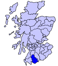
Stewartry
Appearance
54°58′48″N 3°48′36″W / 54.980°N 3.810°W

Stewartry is a committee area in Dumfries and Galloway, Scotland.
It was formerly (1975-96) one of four local government districts in the Dumfries and Galloway Region of Scotland.
The district was formed by the Local Government (Scotland) Act 1973, and took its name from The Stewartry of Kirkcudbright, the original designation of the former county of Kirkcudbrightshire, which covered a slightly larger area.
In 1996 the district was abolished, with its area becoming part of the Dumfries and Galloway unitary authority area, with an identical area to the region.
See also
External links
- Community website listing community events in the Stewartry Region
- Web site about Dalbeattie, major Town in the Stewartry
