Stitswerd
Appearance
Stitswerd | |
|---|---|
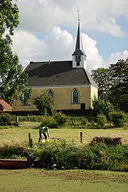
 The church of Stitswerd | |
| Country | Netherlands |
| Province | Groningen |
| Municipality | Eemsmond |
| Population (2008) | 70 |
Stitswerd is a village in the municipality of Eemsmond, Groningen, the Netherlands. The village has about 120 inhabitants. Stitswerd is located on a wierde near the estuary of the former river Fivel.
Stitswerd has the highest postal code in the Netherlands (9999 XL).
References
External links
 Media related to Stitswerd at Wikimedia Commons
