
Strančice
You can help expand this article with text translated from the corresponding article in Czech. (July 2009) Click [show] for important translation instructions.
|
Strančice | |
|---|---|
Municipality and village | |
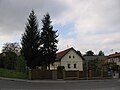
 New housing in Strančice | |
 Flag  Coat of arms | |
 | |
| Country | |
| Region | Central Bohemian Region |
| District | Prague-East District |
| Area | |
| • Total | 4.48 sq mi (11.61 km2) |
| Elevation | 1,362 ft (415 m) |
| Population (2011) | |
| • Total | 1,986 |
| • Density | 440/sq mi (170/km2) |
| Time zone | UTC+1 (CET) |
| • Summer (DST) | UTC+2 (CEST) |
| Postal code | 251 63 |
Wikimedia Commons has media related to Strančice.
Strančice is a village and municipality in Prague-East District in the Central Bohemian Region of the Czech Republic. The municipality covers an area of 11.61 square kilometres (4.48 sq mi) and as of 2006 it had a population of 1728.
Gallery
-
 Strančice train station
 -
 Municipal office
 -
 Native house of Emil Kolben


References
- This article was initially translated from the Czech Wikipedia.
49°57′N 14°41′E / 49.950°N 14.683°E