
Streefkerk
Streefkerk | |
|---|---|
Town | |
 | |
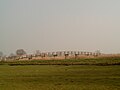
 The town centre (dark green) and the statistical district (light green) of Streefkerk in the former municipality of Liesveld. | |
| Coordinates: 51°32′N 4°27′E / 51.54°N 4.45°E | |
| Country | Netherlands |
| Province | South Holland |
| Municipality | Molenlanden |
| Population (1 January 2004) | 2,600 |
| Major roads | N216 |
Streefkerk is a town in the Dutch province of South Holland. It is a part of the municipality of Molenlanden, and lies on the southside of the river Lek, about 20 kilometres east of Rotterdam.
In 2004, the town of Streefkerk had 2600 inhabitants. The built-up area of the town was 0.37 km2, and contained 628 residences.[1] The statistical area "Streefkerk", which also can include the surrounding countryside, has a population of around 2,600.[2]
Streefkerk was a separate municipality until 1986, when it became part of Liesveld.[3] The latter has been part of Molenwaard since 2013.
-
 Windmill De Liefde
 -
 Cycle bridge


References
- ^ Statistics Netherlands (CBS), Bevolkingskernen in Nederland 2001. (Statistics are for the continuous built-up area).
- ^ Statistics Netherlands (CBS), Statline: Kerncijfers wijken en buurten 2003-2005. As of 1 January 2005.
- ^ Ad van der Meer and Onno Boonstra, Repertorium van Nederlandse gemeenten, KNAW, 2011.
This South Holland location article is a stub. You can help Wikipedia by expanding it. |