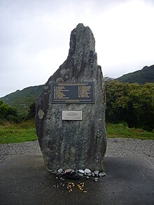
Strongman Mine
Appearance

The Strongman Mine was an underground coal mine north of Greymouth on the West Coast of New Zealand from 1938 to 2003.
On 19 January 1967 a gas explosion in the mine killed 19 miners.[1][2][3]
In 1994 the original mine was replaced by the Strongman 2 mine further up the Nine Mile valley. The Strongman 2 mine closed in 2003. [4]
See also
References
- ^ "19 killed in Strongman mine explosion at Runanga ", NZHistory
- ^ "Old miner remembers Strongman tragedy". The Southland Times. 23 November 2010. Retrieved 14 November 2011.
- ^ "New Zealand Mine Disaster: Toll 19 Dead", The Montreal Gazette - Jan 19, 1967
- ^ "Strongman 2 Underground Mine closes - Replaced by mine at Spring Creek". Solid Energy. 11 August 2003. Retrieved 15 October 2010.
External links
42°20′36″S 171°18′19″E / 42.343225°S 171.305399°E
