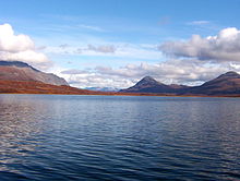
Tangle Lakes
62°59′N 146°02′W / 62.99°N 146.04°W

The Tangle Lakes (Long Tangle Lake, Lower Tangle Lake, Round Tangle Lake, and Upper Tangle Lake[1]) are a 16 miles (26 km) long chain of lakes connected by streams in interior Alaska. They form the headwaters for the Delta River.
The main public access to the Lakes is from a Bureau of Land Management maintained campground and boat launch at Round Tangle Lake, about 20 miles (32 km) from Paxson on the Denali Highway. The boat launch is also the upper terminus of the Delta River Canoe Trail, a 2-3 day route to the Gulkana River and the Richardson Highway.[2] The lakes support many species of fish, including lake trout, burbot, and Arctic grayling. The area around the lakes consists mostly of tundra due to the high elevation (2,864 feet (873 m)).
References
- ^ The Milepost 61st Edition, page 502 ISBN 978-1892-15426-2
- ^ U.S. Geological Survey Geographic Names Information System: Tangle Lakes
