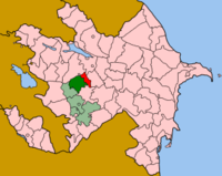
Tartar District
Appearance
This article needs additional citations for verification. (December 2009) |

Tartar (Azerbaijani: Tərtər) is a rayon of Azerbaijan. Most of it has been under the control of the breakaway Nagorno-Karabakh Republic since the Nagorno-Karabakh War, as part of Martakert Province.
IDP's from Nagorno-Karabakh and surrounding occupied regions were moved to Tartar rayon from tent settlements around the country. The IDPs live in new houses built by the government.[1]
References
- ^ "Azerbaijan: Life on the Frontlines". Eurasia.net. 2007-07-05. Retrieved 2010-10-07.

