Te Paepae o Aotea
Appearance

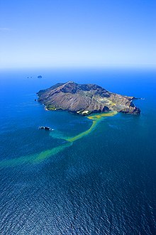
Te Paepae o Aotea, also known the Volkner Rocks (named after Carl Sylvius Völkner), are a group of andesitic rock stacks and pinnacles located 5 kilometres (3.1 mi) northwest of Whakaari/White Island in New Zealand's Bay of Plenty. They reach 113 metres above sea level, while the saddle separating them from Whakaari/White Island is over 200 metres deep.
The Te Paepae o Aotea Marine Reserve was established around them in 2006.[1] The area is popular with divers, due to good visibility (35–40 m), spectacular scenery and colourful marine life.
See also
References
- ^ "Marine Reserve (Te Paepae o Aotea (Volkner Rocks)) Order 2006 (SR 2006/281)". New Zealand Government. 15 September 2006. Retrieved 16 April 2013.
External links
- Te Paepae o Aotea Marine Reserve at the Department of Conservation
- Press release about reserve, Minister of Conservation
