Tesáre

Coordinates: 48°36′N 18°05′E / 48.600°N 18.083°E / 48.600; 18.083
From Wikipedia, the free encyclopedia

This is an old revision of this page, as edited by Eagleash (talk | contribs) at 08:07, 5 December 2016 (bare url). The present address (URL) is a permanent link to this revision, which may differ significantly from the current revision.

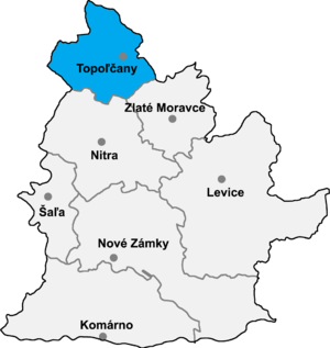
Topoľčany District in Nitra

Tesáre is municipality in the Topoľčany District of the Nitra Region, Slovakia.[1] In 2011 it had 712 inhabitants.[2]

References

  1. ^ "Tesáre - Okres Topoľčany - E-OBCE.sk". en.e-obce.sk. Retrieved 2016-12-05.
  2. ^ http://portal.statistics.sk/files/obce-pohl-vek.pdf

External links

48°36′N 18°05′E / 48.600°N 18.083°E / 48.600; 18.083