The Dungeon SSSI
Appearance
| Site of Special Scientific Interest | |
 | |
| Location | Merseyside |
|---|---|
| Grid reference | SJ251831 |
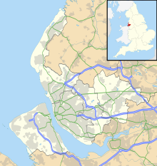
| Coordinates | 53°20′10″N 3°06′22″W / 53.336°N 3.106°W |
| Interest | Geological |
| Area | 1.2 hectares, 2.8 acres (11,000 m2) |
| Notification | 1977 / 1987 |
| Natural England website | |
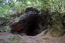
The Dungeon is a 1.2 hectare Site of Special Scientific Interest (SSSI) situated 1 mile north-west of Heswall, on the Wirral Peninsula, England. The site was notified in 1988 due to its geological features which show the Tarporley Siltstone Formation of the Mercia Mudstone Group.

