Titanic, Oklahoma
Appearance
Titanic, Oklahoma | |
|---|---|
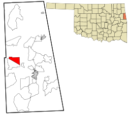
 Location within Adair County and the state of Oklahoma | |
| Coordinates: 35°54′3″N 94°46′19″W / 35.90083°N 94.77194°W | |
| Country | United States |
| State | Oklahoma |
| County | Adair |
| Area | |
• Total | 5.4 sq mi (13.9 km2) |
| • Land | 5.3 sq mi (13.8 km2) |
| • Water | 0.04 sq mi (0.1 km2) |
| Elevation | 1,061 ft (323 m) |
| Population (2010) | |
• Total | 356 |
| • Density | 67/sq mi (25.8/km2) |
| Time zone | UTC-6 (Central (CST)) |
| • Summer (DST) | UTC-5 (CDT) |
| FIPS code | 40-73950[1] |
| GNIS feature ID | 2584394[2] |
Titanic is a census-designated place (CDP) in Adair County, Oklahoma, United States. The population was 356 at the 2010 census.[3]
A post office was established in Titanic, on January 3, 1916, but discontinued on December 31, 1927, with mail to Stilwell.[4][5]
Geography
Titanic is located at 35°54′3″N 94°46′19″W / 35.90083°N 94.77194°W, along the northern side of Oklahoma State Highway 51. It is 11 miles (18 km) northwest of Stilwell, the county seat, and 13 miles (21 km) east of Tahlequah in Cherokee County.
According to the United States Census Bureau, the CDP has a total area of 5.4 square miles (13.9 km2), of which 5.3 square miles (13.8 km2) is land and 0.039 square miles (0.1 km2), or 0.72%, is water.[3]
References
- ^ "American FactFinder". United States Census Bureau. Retrieved 2008-01-31.
- ^ "US Board on Geographic Names". United States Geological Survey. 2007-10-25. Retrieved 2008-01-31.
- ^ a b "Geographic Identifiers: 2010 Demographic Profile Data (G001): Titanic CDP, Oklahoma". U.S. Census Bureau, American Factfinder. Retrieved July 12, 2013.
- ^ Shirk, George H., Oklahoma Place Names, Norman, Oklahoma: University of Oklahoma Press (1965), p 206.
- ^ Helbock, Richard W., Oklahoma Post Offices, Lake Oswego, Oregon: La Posta Publications (1987), p 42.

