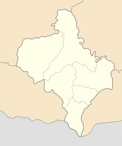
Torhovytsia
Appearance
Torhovytsia
Торговиця | |
|---|---|
| Coordinates: 48°35′44″N 25°26′20″E / 48.59556°N 25.43889°E | |
| Country | Ukraine |
| Oblast | Ivano-Frankivsk Oblast |
| Raion | Kolomyia Raion |
| Hromada | Horodenka urban hromada |
| Time zone | UTC+2 (EET) |
| • Summer (DST) | UTC+3 (EEST) |
| Postal code | 78161 |
Torhovytsia (Ukrainian: Торговиця) is a village in the Horodenka urban hromada of the Kolomyia Raion of Ivano-Frankivsk Oblast in Ukraine.[1]
History
[edit]The first written mention of the village was in 1410.[2]
On 19 July 2020, as a result of the administrative-territorial reform and liquidation of the Horodenka Raion, the village became part of the Kolomyia Raion.[3]
Religion
[edit]- St. Michael church (1906, wooden).[4]
Notable residents
[edit]- Les Martovych (1871–1916), Ukrainian writer and public figure.
In literature
[edit]In 2010, the Marchuk family published a book about the village called "Torgovytsia. Storinky istorii".[2]
References
[edit]- ^ "Городенківська територіальна громада". Децентралізація.
- ^ a b "600-річчя відзначає село Леся Мартовича". Радіо Свобода. 2010-09-21.
- ^ Постанова Верховної Ради України від 17 липня 2020 року No. 807-IX "Про утворення та ліквідацію районів"
- ^ "Храм Архістратига Михаїла села Торговиця". Коломийська єпархія ПЦУ.
Sources
[edit]- "Targowica (3)". Geographical Dictionary of the Kingdom of Poland (in Polish). 12. Warszawa: Kasa im. Józefa Mianowskiego. 1892. p. 172.


