Tsaratanana Airport
Appearance
Tsaratanana Airport | |
|---|---|
| Summary | |
| Airport type | Public/Military |
| Operator | ADEMA (Aéroports de Madagascar) |
| Serves | Tsaratanana |
| Location | Betsiboka, Madagascar |
| Elevation AMSL | 1,073 ft / 372 m |
| Coordinates | 16°45′03″S 47°37′08″E / 16.75083°S 47.61889°E |
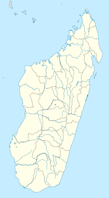
| Map | |
 | |
Source:[1] | |
Tsaratanana Airport is an airport in Tsaratanana, Betsiboka Region, Madagascar (IATA: TTS, ICAO: FMNT).
Scheduled services
| Airlines | Destinations |
|---|---|
| Air Madagascar | Antananarivo |
References
- ^ "TTS Airport Information". Airport Guide. Retrieved 2 July 2015.
External links
16°45′00″S 47°37′01″E / 16.75000°S 47.61700°E

