Tychowo
Appearance
Tychowo | |
|---|---|
Town | |
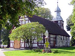
 Church | |
| Coordinates: 53°55′49″N 16°15′39″E / 53.93028°N 16.26083°E | |
| Country | |
| Voivodeship | West Pomeranian |
| County | Białogard |
| Gmina | Tychowo |
| Population | 2,500 |
| Website | http://www.tychowo.pl |
Tychowo [tɨˈxɔvɔ] (German: Groß Tychow) is a town in Białogard County, West Pomeranian Voivodeship, in north-western Poland. It is the seat of the gmina (administrative district) called Gmina Tychowo.[1] It lies approximately 20 kilometres (12 mi) south-east of Białogard and 125 km (78 mi) north-east of the regional capital Szczecin.
Stalag Luft IV was located in the town during World War II.
The town has an approximate population of 2,500. It gained town status on 1 January 2010, and was the newest city in Poland as at July 2012.
References
Wikimedia Commons has media related to Tychowo.
53°55′49″N 16°15′39″E / 53.93028°N 16.26083°E


