
Union Springs, Alabama
Union Springs, Alabama | |
|---|---|
 Location in Bullock County and the state of Alabama | |
| Country | United States |
| State | Alabama |
| County | Bullock |
| Area | |
| • Total | 6.9 sq mi (17.8 km2) |
| • Land | 6.9 sq mi (17.8 km2) |
| • Water | 0 sq mi (0 km2) |
| Elevation | 522 ft (159 m) |
| Population (2000) | |
| • Total | 3,670 |
| • Density | 531.9/sq mi (206.2/km2) |
| Time zone | UTC-6 (Central (CST)) |
| • Summer (DST) | UTC-5 (CDT) |
| ZIP code | 36089 |
| Area code | 334 |
| FIPS code | 01-77880 |
| GNIS feature ID | 0128349 |
Union Springs is a city in and the county seat of Bullock County, Alabama, United States.Template:GR The population was 3,670 at the 2000 census.
Geography
Union Springs is located at 32°8'24.407" North, 85°42'46.094" West (32.140113, -85.712804)Template:GR.
According to the U.S. Census Bureau, the city has a total area of 6.9 square miles (17.8 km²), all of it land.
Demographics
As of the censusTemplate:GR of 2000, there were 3,670 people, 1,393 households, and 909 families residing in the city. The population density was 535.2 people per square mile (206.6/km²). There were 1,617 housing units at an average density of 235.8/sq mi (91.0/km²). The racial makeup of the city was 74.41% Black or African American, 22.81% White, 0.33% Native American, 0.49% Asian, 0.03% Pacific Islander, 0.90% from other races, and 1.04% from two or more races. Hispanic or Latino of any race were 6.84% of the population.
There were 1,393 households out of which 33.5% had children under the age of 18 living with them, 27.5% were married couples living together, 32.7% had a female householder with no husband present, and 34.7% were non-families. 31.2% of all households were made up of individuals and 14.1% had someone living alone who was 65 years of age or older. The average household size was 2.55 and the average family size was 3.15.
In the city the population was spread out with 30.4% under the age of 18, 11.0% from 18 to 24, 25.5% from 25 to 44, 18.9% from 45 to 64, and 14.3% who were 65 years of age or older. The median age was 31 years. For every 100 females there were 88.5 males. For every 100 females age 18 and over, there were 84.0 males.
The median income for a household in the city was $18,520, and the median income for a family was $20,645. Males had a median income of $17,059 versus $15,966 for females. The per capita income for the city was $9,666. About 38.7% of families and 40.1% of the population were below the poverty line, including 55.8% of those under age 18 and 18.8% of those age 65 or over. Please note the different between the median average and mean average.
Notable natives
- Winton M. Blount - United States Postmaster General (1969-1972)
- John Warren Branscomb - Methodist bishop.
- John Henrik Clarke - Significant Pan-Africanist.
- Eddie Kendricks - Co-founder of The Temptations. (Family moved when he was young)
References
External links
Municipalities and communities of Bullock County, Alabama, United States | ||
|---|---|---|
| Cities | 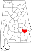 | |
| Towns | ||
| CDP | ||
| Unincorporated communities | ||
| Ghost towns | ||