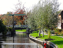
User:Timokorthoef/Belt-Schutsloot
Appearance
Belt-Schutsloot | |
|---|---|
 Belt-Schutsloot 2013 | |
 | |
| Coordinates: 52°40′13″N 6°3′46″E / 52.67028°N 6.06278°E | |
| Country | Netherlands |
| Province | Overijssel |
| Municipality | Steenwijkerland |
| Area | |
| • Total | 1,026 ha (2,535 acres) |
| Population (2017[1]) | |
| • Total | 565 |
| • Density | 55/km2 (140/sq mi) |
| Postal code | 8066 |
| Dialling code | 038 |

