
Võrtsjärv
| Võrtsjärv | |
|---|---|
 | |
| Location | Estonia |
| Coordinates | 58°17′N 26°02′E / 58.283°N 26.033°E |
| Primary inflows | Väike Emajõgi Tänassilma Õhne Tarvastu |
| Primary outflows | Emajõgi |
| Catchment area | 3,100 km2 (1,200 sq mi) |
| Basin countries | Estonia, Latvia |
| Surface area | 270 km2 (100 sq mi) |
| Average depth | 2.7 m (8 ft 10 in) |
| Max. depth | 6 m (20 ft) |
| Water volume | 0.8 km3 (650,000 acre⋅ft) |
| Shore length1 | 96 km (60 mi) |
| Surface elevation | 33.7 m (111 ft) |
| 1 Shore length is not a well-defined measure. | |
Lake Võrtsjärv (German: Wirzsee) is a lake in southern Estonia with an area of 270 km² (104 mi²).
It is the second largest lake in Estonia (behind Lake Peipus),[1] and it is the largest lake situated entirely in Estonia. The shallow lake is 33.7 m (111 ft) above sea level. The river Emajõgi flows from Lake Võrtsjärv to Lake Peipus.
-
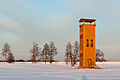 Jõesuu watchtower on the northern shore of Lake Võrtsjärv
 -
 "The shore of Võrtsjärv" by Konrad Mägi. Oil on canvas. 1917
 -
 Tamme outcrop


References
External links
Wikimedia Commons has media related to Võrtsjärv.
- Information on Lake Võrtsjärv
- Awarded "EDEN - European Destinations of Excellence" non traditional tourist destination 2010
This Estonia location article is a stub. You can help Wikipedia by expanding it. |