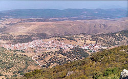
Villarta de los Montes
Appearance
Villarta de los Montes | |
|---|---|
 | |
 | |
| Country | Spain |
| Autonomous community | Extremadura |
| Province | Badajoz |
| Comarca | La Siberia |
| Government | |
| • Alcalde | David Rodríguez Castellanos |
| Area | |
• Total | 123.3 km2 (47.6 sq mi) |
| Elevation | 551 m (1,808 ft) |
| Population (2007) | |
• Total | 595 |
| Time zone | UTC+1 (CET) |
| • Summer (DST) | UTC+2 (CEST) |
Villarta de los Montes is a Spanish municipality in the province of Badajoz, Extremadura. It has a population of 595 (2007) and an area of 123.3 km².


