Vils (Naab)
| Vils | |
|---|---|
 | |
| Location | |
| Country | Germany |
| Physical characteristics | |
| Source | |
| • location | Upper Palatinate |
| Mouth | |
• location | Naab |
• coordinates | 49°9′32″N 11°57′19″E / 49.15889°N 11.95528°E |
| Length | 87.4 km (54.3 mi) [1] |
| Basin size | 1,239 km2 (478 sq mi) [1] |
| Basin features | |
| Progression | Naab→ Danube→ Black Sea |
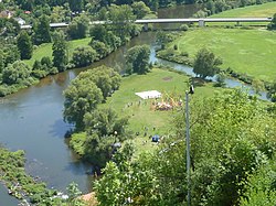
The Vils is a river in Bavaria, Germany, right tributary of the Naab. Its source is near Freihung. It is approx. 87 km long. It flows generally south through the towns Vilseck, Amberg and Schmidmühlen. It flows into the Naab in Kallmünz.
References
- ^ a b Complete table of the Bavarian Waterbody Register by the Bavarian State Office for the Environment (xls, 10.3 MB)
