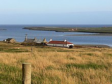
Virkie
Appearance

Virkie is the most southerly district of Shetland, other than Fair Isle and is best defined as the area south of the Ward Hill in Dunrossness, also locally referred to as "below da hill" (below the hill), or "da laich Ness" (the low headland).
Virkie encompasses the following settlements; Exnaboe, Toab, Scatness, and Sumburgh.
Attractions
See also
External links
Sources
- This article is based on http://shetlopedia.com/Virkie a GFDL wiki.
