Vũ Thư district
Appearance
You can help expand this article with text translated from the corresponding article in Vietnamese. (March 2009) Click [show] for important translation instructions.
|
Vũ Thư district
Huyện Vũ Thư | |
|---|---|
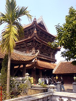
 View of the side of Keo Pagoda | |
 | |
| Country | |
| Region | Red River Delta |
| Province | Thái Bình |
| Capital | Vũ Thư |
| Area | |
| • Total | 77 sq mi (199 km2) |
| Population (2003) | |
| • Total | 229,406 |
| Time zone | UTC+07:00 (Indochina Time) |
Vũ Thư is a rural district of Thái Bình province in the Red River Delta region of Vietnam. As of 2003 the district had a population of 229,406.[1] The district covers an area of 199 km². The district capital lies at Vũ Thư.[1]
References
[edit]- ^ a b "Districts of Vietnam". Statoids. Retrieved March 20, 2009.

