
Walltown, Kentucky
Walltown | |
|---|---|
 Walltown Location within the state of Kentucky  Walltown Walltown (the United States) | |
| Coordinates: 37°19′20″N 84°43′54″W / 37.32222°N 84.73167°W | |
| Country | United States |
| State | Kentucky |
| County | Casey |
| Elevation | 1,234 ft (376 m) |
| Time zone | UTC-6 (Central (CST)) |
| • Summer (DST) | UTC-5 (EST) |
| GNIS feature ID | 509307[1] |
Walltown is a rural unincorporated community in eastern Casey County, Kentucky, United States. It was named for Robert Wall, who purchased 700 acres (2.8 km²) of land in the area in 1807.[2] Its post office operated from 1886 to 1907.
References
- ^ U.S. Geological Survey Geographic Names Information System: Walltown, Kentucky
- ^ Rennick, Robert M. (1988). Kentucky Place Names. University Press of Kentucky. p. 308. ISBN 978-0-8131-0179-8.
Municipalities and communities of Casey County, Kentucky, United States | ||
|---|---|---|
| City | 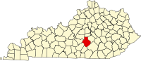 | |
| Unincorporated Communities | ||
| Ghost Towns | ||
This Casey County, Kentucky state location article is a stub. You can help Wikipedia by expanding it. |