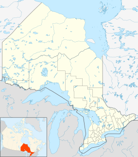
White Lake Provincial Park (Ontario)
Appearance
| White Lake Provincial Park | |
|---|---|
| Location | Ontario, Canada |
| Nearest city | White River, Ontario |
| Coordinates | 48°43′10″N 85°38′40″W / 48.71944°N 85.64444°W |
| Area | 17.26 km2 (6.66 sq mi) |
| Established | 1963[1] |
| Governing body | Ontario Parks |
White Lake Provincial Park is a park in Ontario, Canada, along Highway 17, north of Lake Superior.
The park includes portions of the shore of White Lake with sandy beaches and marshes. Once a rich source of furs and lumber, now it offers natural treasures such as orchids and bogs with insect-eating plants.
References
- ^ "White Lake Provincial Park - Natural Environment". ProtectedPlanet. Archived from the original on 25 August 2014.

