Wijnaldum
Wijnaldum | |
|---|---|
Village | |
 | |
| Country | Netherlands |
| Province | Friesland |
| Population | |
| • Total | c. 100 |
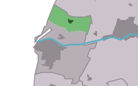
Wijnaldum (Template:Lang-fry) is a village in northwest Friesland, the Netherlands. The village lies within the municipality of Harlingen; prior to 1984, it was a part of the municipality of Barradeel. The village center has approximately 100 residents, with about 490 residents in the entire village (including the neighborhoods of Lutkeburen, Haule and Voorryp).
The village church, traditionally Dutch Reformed (Hervormde) and now part of the Protestant Church in the Netherlands, was dedicated to St. Anthony prior to the Reformation. Ruins from a tower that collapsed in 1684 are still visible on the church's north side. The church is particularly known for its detailed, wood-carved pulpit dating from 1729.
The discovery of a fibula of exquisite quality started archaeological research, from which could be concluded that Wijnaldum was already an important establishment in the 7th century. This history has been visualized in an archaeological annex located in the old consistory building in the village.
Further research showed that during that time in Wijnaldum, buildings existed belonging to gold and silver smiths, bronze casting craftsmen, glass and amber craftsmen, weavers and a weapon smith. Amongst others, also a dirham (an Arab coin) that was placed into an ornament was discovered during excavation. This had possibly found its way there through trade with Vikings.


References
- J.C. Besteman, J.M. Bos, D.A. Gerrets e.a. (1999), The Excavations at Wijnaldum: Reports on Frisia in Roman and Medieval Times, Taylor & Francis, ISBN 9054104880
53°11′42″N 5°27′35″E / 53.19500°N 5.45972°E
