Wormerveer
Appearance
Wormerveer | |
|---|---|
 | |
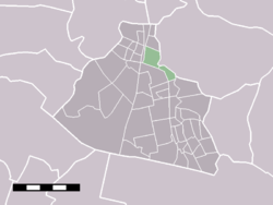
 Wormerveer in the municipality of Zaanstad. | |
| Country | Netherlands |
| Province | Noord-Holland |
| Municipality | Zaanstad |
| Population | 11 225 |
52°29′N 4°47′E / 52.483°N 4.783°E
Wormerveer is a town in the Dutch province of North Holland. It is a part of the municipality of Zaanstad, and lies about 13 km northwest of Amsterdam.
Wormerveer has a population of around 11,225.[1]
Wormerveer was a separate municipality until 1974, when it became a part of the new municipality of Zaanstad.[2]
Transportation
- Railway station Wormerveer
There are 4 trains per hour from Monday to Friday to Amsterdam.
2 trains per hour operate on Saturdays and Sundays.
Notable people
- Herman Gorter
- Gerrit Mannoury
- Hamlet Oddsocks prominent LTO member
- Piet-Hein Out Dutch circus photographer
References
- ^ Statistics Netherlands (CBS), Statline: Kerncijfers wijken en buurten 2004-2010 [1]. As of 7 February 2011.
- ^ Ad van der Meer and Onno Boonstra, Repertorium van Nederlandse gemeenten, KNAW, 2011.
External links
- Template:Kuyper Map of the former municipality, around 1868.

