Yaouk
Appearance
| Yaouk New South Wales | |||||||||||||||
|---|---|---|---|---|---|---|---|---|---|---|---|---|---|---|---|
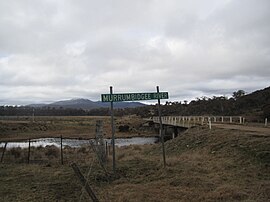
 Murrumbidgee River at Yaouk | |||||||||||||||
| Coordinates | 35°48′57″S 148°48′02″E / 35.81583°S 148.80056°E | ||||||||||||||
| Population | 25 (2016 census)[1] | ||||||||||||||
| Postcode(s) | 2629 | ||||||||||||||
| Location | |||||||||||||||
| LGA(s) | Snowy Monaro Regional Council | ||||||||||||||
| Region | Monaro | ||||||||||||||
| County | Cowley | ||||||||||||||
| Parish | Yaouk | ||||||||||||||
| State electorate(s) | Monaro | ||||||||||||||
| Federal division(s) | Eden-Monaro | ||||||||||||||
| |||||||||||||||
Yaouk (/ˈjaɪjæk/) is a locality in the Snowy Monaro Region, New South Wales, Australia.[2][3] It lies in open grassland valleys surrounded by mountains on both sides of the Murrumbidgee River, downstream from and east of the Tantangara Dam, north of Adaminaby, east of the Kosciuszko National Park and south of the Namadgi National Park in the Australian Capital Territory, but separated from it by the mountainous Scabby Range. It is about 110 km south of Canberra and about 75 km northwest of Cooma. At the 2016 census, it had a population of 25.[1]
Heritage listing
Yaouk has a number of heritage-listed sites, including:
- Sams River Fire Trail: Scabby Range Nature Reserve[4][5]
References
- ^ a b Australian Bureau of Statistics (27 June 2017). "Yaouk". 2016 Census QuickStats. Retrieved 3 April 2018.
- ^ "Yaouk". Geographical Names Register (GNR) of NSW. Geographical Names Board of New South Wales. Retrieved 3 April 2018.
- ^ "Yaouk". OpenStreetMap. Retrieved 3 April 2018.
- ^ "Scabby Range Nature Reserve (Place ID 13624)". Australian Heritage Database. Australian Government. Retrieved 11 October 2018.
- ^ "Australian Alps National Parks and Reserves (Place ID 105891)". Australian Heritage Database. Australian Government. Retrieved 11 October 2018.

