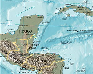
Yucatán Channel
Appearance

The Yucatán Channel is a strait between Mexico and Cuba. It connects the Yucatán Basin of the Caribbean Sea with the Gulf of Mexico. The strait is 217 kilometres (135 mi) across between Cape Catoche in Mexico and Cape San Antonio, Cuba[1] and reaches a maximum depth of 2,779 metres (9,117 ft).[2]
See also
References
21°34′42″N 85°54′27″W / 21.57833°N 85.90750°W
