
Zandt
Zandt | |
|---|---|
 Town hall | |
 Coat of arms | |
Location of Zandt within Cham district 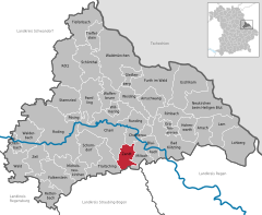 | |
 Zandt  Zandt | |
| Coordinates: 49°9′N 12°44′E / 49.150°N 12.733°E | |
| Country | Germany |
| State | Bavaria |
| Admin. region | Oberpfalz |
| District | Cham |
| Subdivisions | 2 Ortsteile |
| Government | |
| • Mayor | Ludwig Klement (CSU) |
| Area | |
| • Total | 21.61 km2 (8.34 sq mi) |
| Elevation | 472 m (1,549 ft) |
| Population (2022-12-31)[1] | |
| • Total | 2,084 |
| • Density | 96/km2 (250/sq mi) |
| Time zone | UTC+01:00 (CET) |
| • Summer (DST) | UTC+02:00 (CEST) |
| Postal codes | 93499 |
| Dialling codes | 0 99 44 |
| Vehicle registration | CHA |
| Website | www.gemeinde-zandt.de |
Zandt is a municipality in the district of Cham in Bavaria in Germany.
References
- ^ Genesis Online-Datenbank des Bayerischen Landesamtes für Statistik Tabelle 12411-003r Fortschreibung des Bevölkerungsstandes: Gemeinden, Stichtag (Einwohnerzahlen auf Grundlage des Zensus 2011).
Towns and municipalities in Cham (district) | ||
|---|---|---|
|  | |
| International | |
|---|---|
| National | |
This Cham district location article is a stub. You can help Wikipedia by expanding it. |